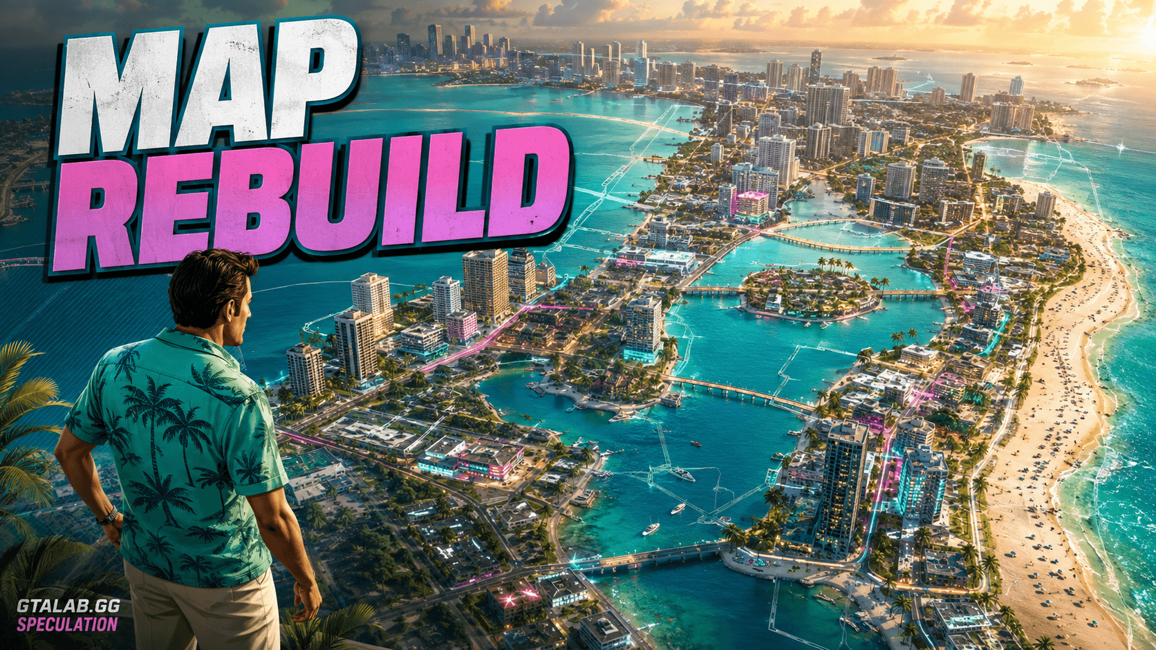
A fan called noasden spent roughly 145 hours reverse-engineering the GTA 6 map inside Cities: Skylines 2 — and the result is more than a curiosity. It's a working, traffic-simulated, resident-populated recreation of Vice City, Vice Beach, the Leonida Keys, and Port Gellhorn, all stitched together from trailer frames and community screenshots. That makes it one of the most structurally detailed fan interpretations of the GTA 6 Vice City map ever assembled — and worth taking seriously as a lens on what Rockstar is actually building.
The honest caveat first: nothing here is confirmed by Rockstar Games. Every district boundary, every highway spur, every waterway is an inference. But the methodology behind this GTA 6 map fan recreation is rigorous enough that it deserves its own analysis — not as ground truth, but as the sharpest community estimate we have in mid-2026.
What Noasden Actually Built
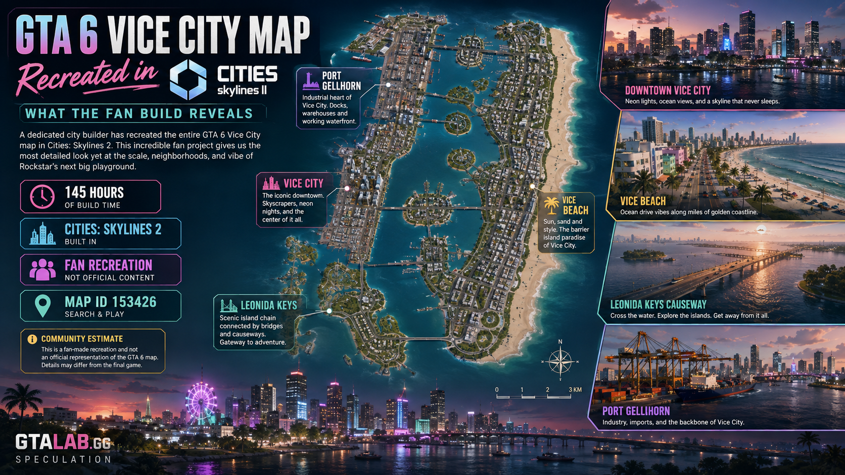
The Cities: Skylines 2 map (loadable via map ID 153426, provided you own the base game and required add-ons) is described by its creator as a true 1:1 scale recreation of the GTA 6 Community Mapping Project's fan-assembled layout. That project, which published an April 2026 update, itself draws on systematic frame-by-frame analysis of both GTA 6 trailers plus leaked screenshots and social media clips.
The recreation includes four primary regions:
Vice City — the dense urban core, modeled after a compressed Miami-Dade metro grid
Vice Beach — barrier island strip with a clear Ocean Drive analogue running north–south
The Leonida Keys — a chain of small islands connected by a long causeway, inspired by the Florida Keys
Port Gellhorn — an industrial port district sitting northwest of the city center
Functional traffic AI runs on the road network, and simulated residents populate the zones. That's not just cosmetic: to route traffic correctly, noasden had to commit to specific intersection geometry and arterial hierarchies — decisions that reveal implicit structural assumptions about how the real map is organized.
What the Layout Tells Us About the Real Vice City
The urban core is denser than GTA V's Los Santos
In the fan map, the Vice City downtown grid is noticeably more compact relative to the surrounding sprawl than Los Santos ever was. The block sizes in the CBD analogue are shorter, with more frequent intersections — consistent with Miami's actual street cadence in areas like Brickell and Downtown. If the fan map's proportions hold, players should expect tighter high-speed driving corridors and more verticality than GTA V offered.
The barrier island creates a natural east–west split
Vice Beach sits on a barrier island separated from the mainland by a Biscayne Bay equivalent. The fan map commits to two primary bridge crossings — north and south — which funnels cross-water movement into predictable chokepoints. This matches what community analysts have identified in trailer footage: a wide multi-lane causeway visible in at least two distinct shots. If Rockstar honors that geography, expect those bridges to be narrative and mission-critical locations.
The Keys stretch further south than most estimates assumed
Earlier community maps compressed the Leonida Keys into a relatively short chain. Noasden's version, informed by the April 2026 Mapping Project update, extends the Keys significantly further south — adding distance and implying more varied island biomes than the trailer's quick cuts suggested. This is the area of the fan map with the lowest confidence; trailer coverage of the Keys is sparse, and the southern extent is largely inferred.
Port Gellhorn anchors the industrial northwest
The port district's placement in the northwest corner of the urban area is one of the more consistent data points across multiple community mapping efforts. Trailer footage includes industrial cranes, container stacks, and what appears to be a working waterway — all of which point northwest of the city center. Noasden's Cities: Skylines 2 version formalizes that placement with a full road network connecting the port to the main freeway loop.
How Does It Compare to Real Miami?
Feature | Real Miami-Dade | Fan Map (est.) | Confidence |
|---|---|---|---|
Downtown grid density | Short blocks, ~100m avg | Compressed, ~80–110m (est.) | Rumored |
Barrier island width | Miami Beach: ~1–2 km | Similar proportion (est.) | Rumored |
Bay crossing count | Multiple (MacArthur, Julia Tuttle, etc.) | 2 primary bridges (est.) | Rumored |
Keys chain length | ~180 km (Florida Keys) | Significantly compressed (est.) | Rumored |
Port location | PortMiami — southeast, near downtown | Northwest (est.) — deliberate remap | Rumored |
One detail stands out: Rockstar appears to have deliberately moved the port. Miami's real PortMiami sits southeast, almost adjacent to downtown. Every credible community map, including noasden's, puts Port Gellhorn to the northwest. That's not an error in the fan work — it's a consistent signal that Rockstar reshuffled the city's industrial geography for gameplay reasons, likely to free up the southeast waterfront for a more scenic, mission-friendly zone.
Can We Trust Fan Reverse-Engineering?
This is the real question. The GTA 6 Community Mapping Project is methodologically honest: contributors timestamp every claim, tag uncertain areas, and update when new footage contradicts earlier assumptions. The April 2026 revision incorporated new detail from social media clips and a Blender-based 3D model published by another community group — which means the source noasden used is itself a multi-layered community consensus, not one person's guess.
That's worth something. Compared to what community analysts extracted from GTA V's pre-release trailers versus the shipped map, the broad strokes — city location, island structure, approximate road hierarchy — tended to survive. Fine-grained details (exact alley widths, interior district names, rural road density) did not.
Apply the same filter here:
Probably reliable: The four-region structure (city, beach island, keys, port). The bay separation. The northwest port placement. The general scale relationship between urban and rural areas.
Probably unreliable: Exact district boundaries. The southern extent of the Keys. Interior road geometry. Any detail sourced from a single ambiguous trailer frame.
Completely unverifiable until release: Map size in square kilometers, interior building density, rural biome distribution.
Insiders, including NateTheHate, have hinted that Rockstar could show a more comprehensive look at Leonida before release — possibly as late as August 2026. If a third trailer or gameplay reveal drops, it will either validate or invalidate large sections of the community map. Until then, noasden's Cities: Skylines 2 build is the most playable approximation of the GTA 6 map size and structure that exists.
Why This Kind of Fan Work Actually Matters
It's easy to dismiss a fan Cities: Skylines map as entertainment. It's harder to ignore 145 hours of structured inference. What noasden published isn't a guess — it's a falsifiable hypothesis. When GTA 6 ships on November 19, 2026, the community will be able to compare this map against the real one region by region. That comparison will tell us a lot about how reliable trailer analysis is as a method — which matters for every future Rockstar release.
More immediately, the Cities: Skylines 2 format has a practical advantage: you can drive it. Players exploring the fan map are building intuitions about Vice City's geography — where the highway exits are, how long it takes to cross the bay, which parts of the Keys feel remote. Those intuitions may not survive contact with the real game. But they're more grounded than anything you'll build by staring at a static image.
If you own Cities: Skylines 2 and the required add-ons, load map ID 153426 and form your own opinion. Just remember: treat every district label and road line as community estimate, not Rockstar canon.
FAQ
Q. What is the Cities: Skylines 2 GTA 6 fan map, and how do I find it? User noasden built a playable recreation of the GTA 6 Vice City map in Cities: Skylines 2, including Vice City, Vice Beach, the Leonida Keys, and Port Gellhorn. It can be loaded using map ID 153426 if you own the base game and required add-ons.
Q. How accurate is the GTA 6 fan map recreation? It's based on the GTA 6 Community Mapping Project's April 2026 update, which uses systematic trailer and screenshot analysis. Broad structural features — the four-region layout, bay separation, northwest port — are reasonably consistent across multiple community efforts. Fine details like exact district boundaries and the Keys' southern extent are low-confidence estimates.
Q. How big is the GTA 6 Vice City map compared to GTA V's Los Santos? No official size has been confirmed by Rockstar. Community estimates (est.) suggest the full Leonida state map is significantly larger than GTA V's map, but exact square-kilometer figures remain unverified speculation until official gameplay footage is released.
Q. Why does the fan map place Port Gellhorn in the northwest when Miami's real port is southeast? This appears to be a deliberate Rockstar design choice, not a fan error. Multiple independent community mapping efforts consistently place the port district in the northwest, suggesting Rockstar reorganized the city's geography — likely to open up the southeast waterfront for gameplay and narrative purposes.
Q. When will we get official confirmation of the GTA 6 map layout? GTA 6 is scheduled to release on November 19, 2026. Community insiders have suggested Rockstar may show more of Leonida before launch, potentially around August 2026. Until official footage arrives, all map layout details remain community estimates.